
Faidhle:Usa edcp relief location map.png

Meud an ro-sheallaidh seo: 800 × 495 piogsail. Dùmhlachdan-breacaidh eile: 320 × 198 piogsail | 640 × 396 piogsail | 1,181 × 731 piogsail.
Am faidhle tùsail (1,181 × 731 pixel, meud an fhaidhle: 1.56 MB, seòrsa MIME: image/png)
Gearr-chunntas
| Tuairisgeul |
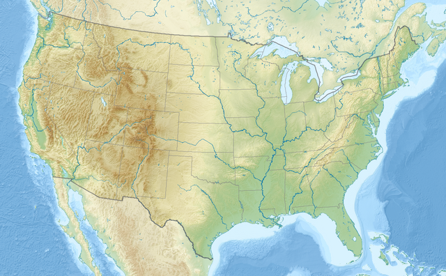
English: Relief location map of the USA (without Hawaii and Alaska).
EquiDistantConicProjection : Central parallel : * N: 37.0° N Central meridian : * E: 96.0° W Standard parallels: * 1: 32.0° N * 2: 42.0° N Made with Natural Earth. Free vector and raster map data @ naturalearthdata.com. Formulas for x and y: x = 50.0 + 124.03149777329222 * ((1.9694462586094064-({{{2}}}* pi / 180))
* sin(0.6010514667026994 * ({{{3}}} + 96) * pi / 180))
y = 50.0 + 1.6155950752393982 * 124.03149777329222 * 0.02613325650382181
- 1.6155950752393982 * 124.03149777329222 *
(1.3236744353715044 - (1.9694462586094064-({{{2}}}* pi / 180))
* cos(0.6010514667026994 * ({{{3}}} + 96) * pi / 180))
|
| Ceann-là | |
| Tùs | M’ obair fhèin |
| Ùghdar | Uwe Dedering |
| Other versions |
|

Ceadachadh
I, the copyright holder of this work, hereby publish it under the following licenses:
Tha am faidhle seo fo cheadachas Creative Commons Attribution-Share Alike 3.0 Unported.
- Faodaidh tu:
- a cho-roinneadh – lethbhreac a dhèanamh dhen obair, a sgaoileadh is a tar-chur
- ath-mheasgachadh – an obair atharrachadh
- Fo bhuaidh nan cumhaichean a leanas:
- urram – Feumaidh tu iomradh a thoirt air an ùghdar no an neach aig a bheil cead air, dìreach mar a thoill iad (ach chan ann air dòigh a chuireas an sùilean dhaoine gu bheil iad ag aontachadh riut no ri d’ obair).
- co-roinneadh co-ionnann – Ma dh’atharraicheas tu no ma leasaicheas tu an obair seo, ’s urrainn an tionndadh ùr fon cheadachas seo no fo cheadachas coltach ris.

|
Permission is granted to copy, distribute and/or modify this document under the terms of the GNU Free Documentation License, Version 1.2 or any later version published by the Free Software Foundation; with no Invariant Sections, no Front-Cover Texts, and no Back-Cover Texts. A copy of the license is included in the section entitled GNU Free Documentation License. |
’S urrainn dhut an ceadachas as fhearr leat a thaghadh.
Eachdraidh an fhaidhle
Briog air ceann-là/àm gus am faidhle a shealltainn mar a nochd e aig an àm sin.
| Ceann-là/Àm | Dealbhag | Meud | Cleachdaiche | Beachd | |
|---|---|---|---|---|---|
| làithreach | 20:50, 2 dhen Ghiblean 2024 | | 1,181 × 731 (1.56 MB) | Spesh531 | correction to Rhode Island border. Little Compton and Tiverton was previously shown to be in Massachusetts |
| 16:32, 23 dhen Dùbhlachd 2016 |  | 1,181 × 731 (1.47 MB) | Jeanjung212 | Lossless Compressed/optimized png decreasing file size by 193731 bytes | |
| 10:37, 24 dhen Lùnastal 2010 |  | 1,181 × 731 (1.66 MB) | Uwe Dedering | {{Information |Description={{en|1=Relief location map of the USA (without Hawaii and Alaska). EquiDistantConicProjection : Central parallel : * N: 37.0° N Central meridian : * E: 96.0° W Standard parallels: * 1: 32.0° N * 2: 42.0° N Made with Nat |
Cleachdadh an fhaidhle
Tha ceangal ris an fhaidhle seo san duilleag a leanas:
Cleachdadh fhaidhlichean uile-choitcheann
Tha na uicidhean eile a leanas a’ cleachdadh an fhaidhle seo
- Cleachdadh air ab.wikipedia.org
- Cleachdadh air ace.wikipedia.org
- Cleachdadh air als.wikipedia.org
- Cleachdadh air ang.wikipedia.org
- Cleachdadh air ar.wikipedia.org
- قالب:خريطة مواقع
- قالب:خريطة مواقع/شرح
- قالب:خريطة مواقع الولايات المتحدة
- قالب:خريطة مواقع الولايات المتحدة2
- قالب:خريطة مواقع/ملعب
- وحدة:Location map/data/USA
- وحدة:Location map/data/United States
- وحدة:Location map/data/USA/شرح
- وحدة:Location map/data/United States of America
- كلية مونماوث
- وحدة:Location map/data/United States/شرح
- وحدة:Location map/data/United States of America/شرح
- بوينغ فيلد
- جامعات أمريكية حسب عدد الملتحقين بالمرحلة الجامعية
- جامعات الولايات المتحدة حسب عدد المسجلين
- فورتشن 1000
- تكوين هيل كريك
- انفجار صاروخ تيتان في داماسكيوس 1980
- تحطم طائرة بوينغ بي-52 في قاعدة فيرتشايلد الجوية
- Cleachdadh air arz.wikipedia.org
- Cleachdadh air ast.wikipedia.org
- Cleachdadh air as.wikipedia.org
- Cleachdadh air av.wikipedia.org
- Cleachdadh air azb.wikipedia.org
Seall an corr dhen chleachdadh uile-choitcheann a nithear dhen fhaidhle seo.