
Faidhle:Wales Wrexham locator map.svg

Size of this PNG preview of this SVG file: 502 × 600 piogsail. Dùmhlachdan-breacaidh eile: 201 × 240 piogsail | 402 × 480 piogsail | 643 × 768 piogsail | 857 × 1,024 piogsail | 1,714 × 2,048 piogsail | 1,047 × 1,251 piogsail.
Am faidhle tùsail (Faidhle SVG, a-rèir ainm 1,047 × 1,251 pixel, meud faidhle: 147 KB)
Gearr-chunntas
| Tuairisgeul |
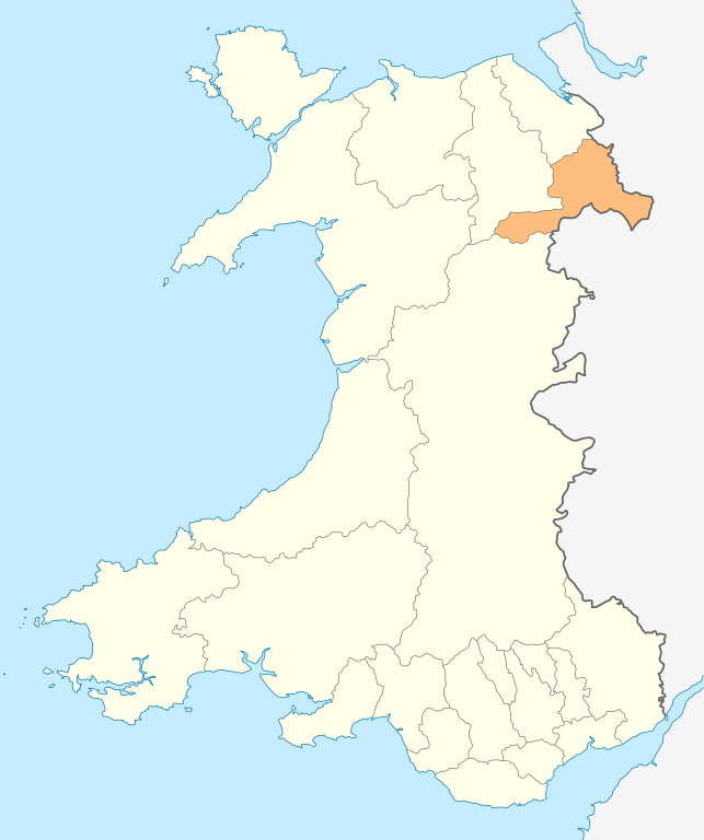
Deutsch: Lagekarte von Wrexham in Wales
English: Locator map of Wrexham in Wales |
| Ceann-là | |
| Tùs | M’ obair fhèin |
| Ùghdar | NordNordWest |
| Cead (Ag ath-chleachdadh an fhaidhle seo) |
I, the copyright holder of this work, hereby publish it under the following license: Tha am faidhle seo fo cheadachas Creative Commons Attribution-Share Alike 3.0 Unported.
|

|
This map has been made or improved in the German Kartenwerkstatt (Map Lab). You can propose maps to improve as well.
|
Eachdraidh an fhaidhle
Briog air ceann-là/àm gus am faidhle a shealltainn mar a nochd e aig an àm sin.
| Ceann-là/Àm | Dealbhag | Meud | Cleachdaiche | Beachd | |
|---|---|---|---|---|---|
| làithreach | 19:00, 4 dhen Chèitean 2010 | | 1,047 × 1,251 (147 KB) | NordNordWest | {{int:filedesc}} {{Information |Description= {{de|Lagekarte von Wrexham in Wales}} {{en|Locator map of Wrexham in Wales}} |Source={{Own}} |Date=2010-05-04 |Author={{U|NordNordWest}} |Permission={{self|cc-by-sa-3.0}} |other_versions= }} {{Kartenwerkstatt} |
Cleachdadh an fhaidhle
Tha ceangal ris an fhaidhle seo san duilleag a leanas:
Cleachdadh fhaidhlichean uile-choitcheann
Tha na uicidhean eile a leanas a’ cleachdadh an fhaidhle seo
- Cleachdadh air en.wikipedia.org
- Berwyn range
- Wrexham
- Bangor-on-Dee
- Pontcysyllte Aqueduct
- Chirk
- Maelor
- English Maelor
- Wrexham County Borough
- Wrexham University
- Glyn Valley Tramway
- Rhosllanerchrugog
- Ruabon
- Rhosrobin
- All Saints' Church, Gresford
- Overton-on-Dee
- Coedpoeth
- Chirk Castle
- Chirk Aqueduct
- Fenn's, Whixall and Bettisfield Mosses National Nature Reserve
- St Giles' Church, Wrexham
- Holt, Wrexham
- Acrefair
- Ceiriog Valley
- Gresford
- Cadair Bronwen
- Acton, Wrexham
- Abenbury
- Wrexham Industrial Estate
- Wrexham Lager
- Erddig
- Croes Newydd
- River Clywedog
- Minera
- River Alyn
- Wynn Hall
- Bwlchgwyn
- Cefn Mawr
- Marford
- Bersham Ironworks
- Burton, Wrexham
- Template:Wrexham-geo-stub
- Glyn Ceiriog
- Pontfadog
- Ponciau
- Rossett
- Moss Valley, Wrexham
- Brymbo
- Pen-y-cae, Wrexham
- Erbistock
- Pentre Bychan
Seall an corr dhen chleachdadh uile-choitcheann a nithear dhen fhaidhle seo.