
Faidhle:Strathoykel at Tuiteam Tarbhach.jpg

Meud an ro-sheallaidh seo: 800 × 598 piogsail. Dùmhlachdan-breacaidh eile: 320 × 239 piogsail | 640 × 479 piogsail | 1,024 × 766 piogsail | 1,280 × 958 piogsail | 2,560 × 1,915 piogsail | 2,866 × 2,144 piogsail.
Am faidhle tùsail (2,866 × 2,144 pixel, meud an fhaidhle: 2.66 MB, seòrsa MIME: image/jpeg)
Gearr-chunntas
| Tuairisgeul |
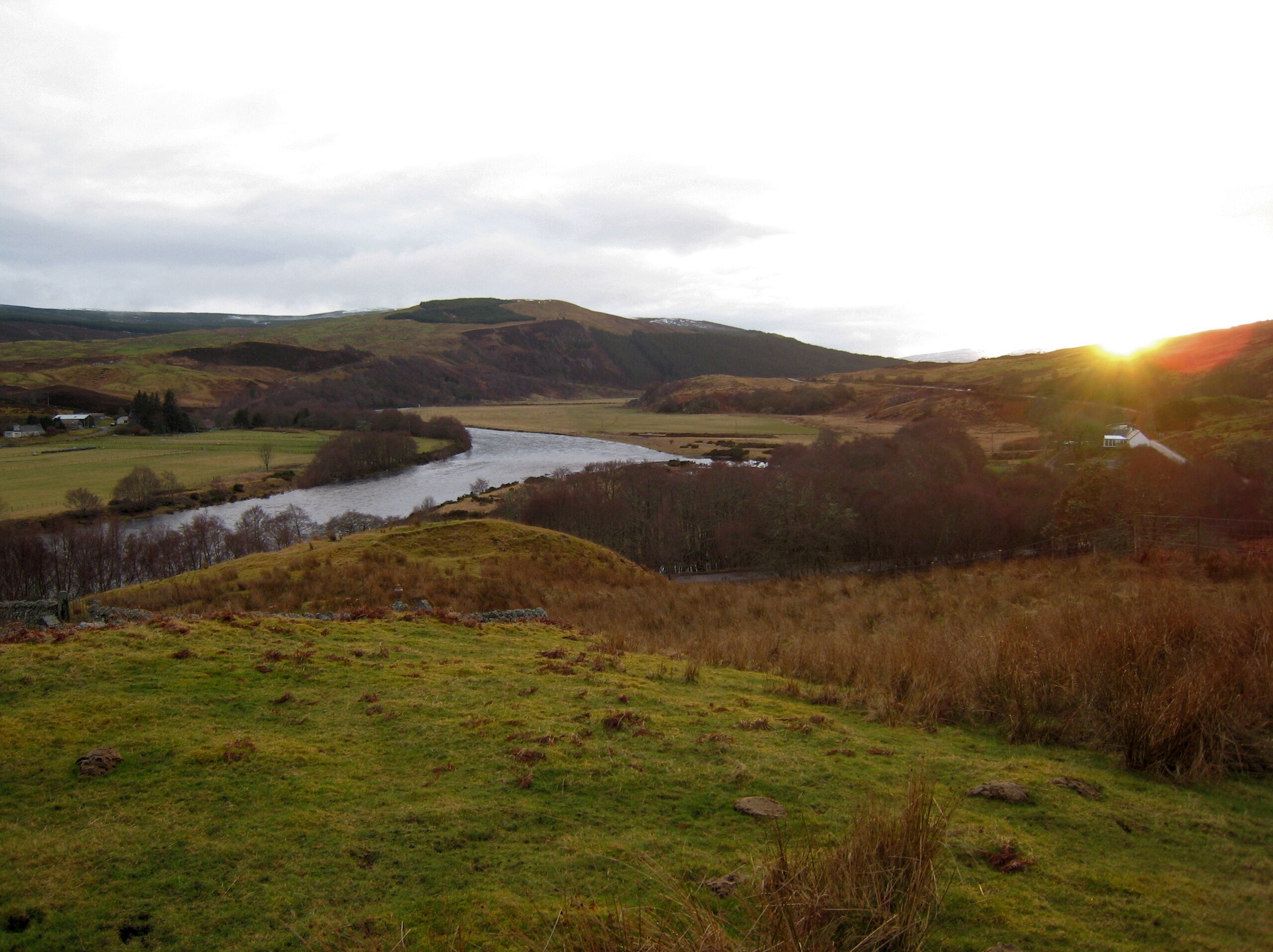
English: View of Strathoykel in northern Scotland looking west (upstream) from Tutim cemetery at sunset. The cemetery wall is in the foreground, Brae farm on the left of the photo, and Tuiteam house on the right. The mouth of the Tutim Burn can be seen entering the River Oykel roughly level with Tuiteam house. The hill is Ben Chreagach. The site is notable for the en:Battle of Tuiteam Tarbhach which took place around Tuiteam house in about 1406. |
| Ceann-là | |
| Tùs | M’ obair fhèin |
| Ùghdar | Le Deluge |
| Camera location | | View this and other nearby images on: OpenStreetMap |
|---|
Ceadachadh
I, the copyright holder of this work, hereby publish it under the following license:
Tha am faidhle seo fo cheadachas Creative Commons Attribution-Share Alike 3.0 Unported.
- Faodaidh tu:
- a cho-roinneadh – lethbhreac a dhèanamh dhen obair, a sgaoileadh is a tar-chur
- ath-mheasgachadh – an obair atharrachadh
- Fo bhuaidh nan cumhaichean a leanas:
- urram – Feumaidh tu iomradh a thoirt air an ùghdar no an neach aig a bheil cead air, dìreach mar a thoill iad (ach chan ann air dòigh a chuireas an sùilean dhaoine gu bheil iad ag aontachadh riut no ri d’ obair).
- co-roinneadh co-ionnann – Ma dh’atharraicheas tu no ma leasaicheas tu an obair seo, ’s urrainn an tionndadh ùr fon cheadachas seo no fo cheadachas coltach ris.
Eachdraidh an fhaidhle
Briog air ceann-là/àm gus am faidhle a shealltainn mar a nochd e aig an àm sin.
| Ceann-là/Àm | Dealbhag | Meud | Cleachdaiche | Beachd | |
|---|---|---|---|---|---|
| làithreach | 03:31, 15 dhen Mhàrt 2009 | | 2,866 × 2,144 (2.66 MB) | Le Deluge | {{Information |Description={{en|1=View of Strathoykel in northern Scotland looking west (upstream) from Tutim cemetery at sunset. The cemetery wall is in the foreground, Brae farm on the left of the photo, and Tuiteam house on the right. The mouth of the |
Cleachdadh an fhaidhle
Tha ceangal ris an fhaidhle seo san duilleag a leanas:
Cleachdadh fhaidhlichean uile-choitcheann
Tha na uicidhean eile a leanas a’ cleachdadh an fhaidhle seo
- Cleachdadh air ca.wikipedia.org
- Cleachdadh air ceb.wikipedia.org
- Cleachdadh air en.wikipedia.org
- Cleachdadh air www.wikidata.org