
Faidhle:South Loch Lomond - geograph.org.uk - 190188.jpg
Chan eil dùmhlachd-bhreacaidh nas fhearr ri fhaighinn.
South_Loch_Lomond_-_geograph.org.uk_-_190188.jpg (640 × 480 pixel, meud an fhaidhle: 49 KB, seòrsa MIME: image/jpeg)
Gearr-chunntas
| Tuairisgeul |
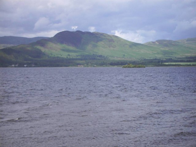
English: South Loch Lomond. Almost an entirely watery square with the exception of the tiny wooded Aber Isle (see Aber_Inch ) in the shallow southern end of Loch Lomond, with Conic Hill in the background. |
| Ceann-là | Taken on 22 dhen Ògmhios 2006 |
| Tùs | From geograph.org.uk |
| Ùghdar | Graham Benny |
| Urram (required by the license) | Graham Benny / South Loch Lomond / |
| Camera location | | View this and other nearby images on: OpenStreetMap |
|---|
_heading:22.00&language=gd)
| Object location | | View this and other nearby images on: OpenStreetMap |
|---|
_heading:22.00&language=gd)
Ceadachadh

|
This image was taken from the Geograph project collection. See this photograph's page on the Geograph website for the photographer's contact details. The copyright on this image is owned by Graham Benny and is licensed for reuse under the Creative Commons Attribution-ShareAlike 2.0 license.
|
This file is licensed under the Creative Commons Attribution-Share Alike 2.0 Generic license.
Urram: Graham Benny
- Faodaidh tu:
- a cho-roinneadh – lethbhreac a dhèanamh dhen obair, a sgaoileadh is a tar-chur
- ath-mheasgachadh – an obair atharrachadh
- Fo bhuaidh nan cumhaichean a leanas:
- urram – Feumaidh tu iomradh a thoirt air an ùghdar no an neach aig a bheil cead air, dìreach mar a thoill iad (ach chan ann air dòigh a chuireas an sùilean dhaoine gu bheil iad ag aontachadh riut no ri d’ obair).
- co-roinneadh co-ionnann – Ma dh’atharraicheas tu no ma leasaicheas tu an obair seo, ’s urrainn an tionndadh ùr fon cheadachas seo no fo cheadachas coltach ris.
Eachdraidh an fhaidhle
Briog air ceann-là/àm gus am faidhle a shealltainn mar a nochd e aig an àm sin.
| Ceann-là/Àm | Dealbhag | Meud | Cleachdaiche | Beachd | |
|---|---|---|---|---|---|
| làithreach | 18:36, 31 dhen Fhaoilleach 2010 | | 640 × 480 (49 KB) | GeographBot | == {{int:filedesc}} == {{Information |description={{en|1=South Loch Lomond. Almost an entirely watery square with the exception of the tiny wooded Aber Isle (see http://en.wikipedia.org/wiki/Aber_Inch ) in the shallow southern end of Loch Lomond, with Con |
Cleachdadh an fhaidhle
Tha ceangal ris an fhaidhle seo san duilleag a leanas:
Cleachdadh fhaidhlichean uile-choitcheann
Tha na uicidhean eile a leanas a’ cleachdadh an fhaidhle seo