
Faidhle:Sgùrr nan Eag 675854.jpg

Meud an ro-sheallaidh seo: 800 × 535 piogsail. Dùmhlachdan-breacaidh eile: 320 × 214 piogsail | 640 × 428 piogsail | 1,024 × 685 piogsail.
Am faidhle tùsail (1,024 × 685 pixel, meud an fhaidhle: 1.23 MB, seòrsa MIME: image/jpeg)
Gearr-chunntas
| Tuairisgeul |
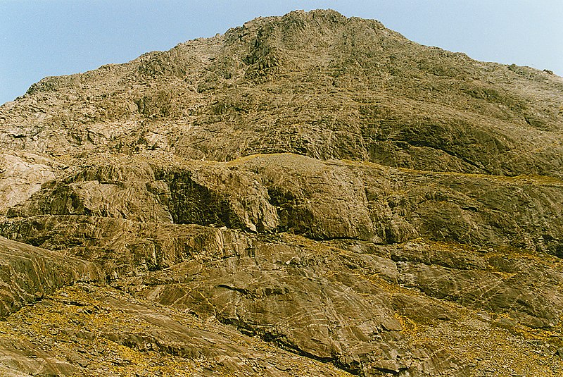
English: The western face of Sgurr nan Eag, 5 km from Bualintur, Highland, Great Britain.
As impressive as they come. On this hot day, the heat reflected off the slabs was frizzling. |
| Ceann-là | |
| Tùs | From this image at geograph.org.uk; transferred by User:RHaworth using geograph_org2commons. |
| Ùghdar | Nigel Brown |
| Cead (Ag ath-chleachdadh an fhaidhle seo) |
Creative Commons Attribution Share-alike license 2.0 |
| Urram (required by the license) | Nigel Brown / The western face of Sgurr nan Eag / |
| Camera location | | View this and other nearby images on: OpenStreetMap |
|---|
| Object location | | View this and other nearby images on: OpenStreetMap |
|---|
_region:GB-SCT_heading:67.00&language=gd)
Ceadachadh

|
This image was taken from the Geograph project collection. See this photograph's page on the Geograph website for the photographer's contact details. The copyright on this image is owned by Nigel Brown and is licensed for reuse under the Creative Commons Attribution-ShareAlike 2.0 license.
|
This file is licensed under the Creative Commons Attribution-Share Alike 2.0 Generic license.
Urram: Nigel Brown
- Faodaidh tu:
- a cho-roinneadh – lethbhreac a dhèanamh dhen obair, a sgaoileadh is a tar-chur
- ath-mheasgachadh – an obair atharrachadh
- Fo bhuaidh nan cumhaichean a leanas:
- urram – Feumaidh tu iomradh a thoirt air an ùghdar no an neach aig a bheil cead air, dìreach mar a thoill iad (ach chan ann air dòigh a chuireas an sùilean dhaoine gu bheil iad ag aontachadh riut no ri d’ obair).
- co-roinneadh co-ionnann – Ma dh’atharraicheas tu no ma leasaicheas tu an obair seo, ’s urrainn an tionndadh ùr fon cheadachas seo no fo cheadachas coltach ris.
Eachdraidh an fhaidhle
Briog air ceann-là/àm gus am faidhle a shealltainn mar a nochd e aig an àm sin.
| Ceann-là/Àm | Dealbhag | Meud | Cleachdaiche | Beachd | |
|---|---|---|---|---|---|
| làithreach | 06:55, 16 dhen Chèitean 2020 | | 1,024 × 685 (1.23 MB) | Geograph Update Bot | Higher-resolution version from Geograph. |
| 22:56, 30 dhen Fhaoilleach 2011 |  | 640 × 428 (116 KB) | File Upload Bot (Magnus Manske) | == {{int:filedesc}} == {{Information |Description={{en|1=The western face of Sgurr nan Eag, 5 km from Bualintur, Highland, Great Britain. As impressive as they come. On this hot day, the heat reflected off the slabs was frizzling.}} |Source=From [http://w |
Cleachdadh an fhaidhle
Tha ceangal ris an fhaidhle seo san duilleag a leanas:
Cleachdadh fhaidhlichean uile-choitcheann
Tha na uicidhean eile a leanas a’ cleachdadh an fhaidhle seo
- Cleachdadh air de.wikipedia.org