
Faidhle:Kinrossmap1945.png
Meud an ro-sheallaidh seo: 618 × 600 piogsail. Dùmhlachdan-breacaidh eile: 247 × 240 piogsail | 494 × 480 piogsail | 961 × 933 piogsail.
Am faidhle tùsail (961 × 933 pixel, meud an fhaidhle: 1.72 MB, seòrsa MIME: image/png)
This work is an Ordnance Survey map over 50 years old, which is covered by Crown Copyright which in this case expires 50 years after publication. Ordnance Survey does however ask that they be credited and that the date of publication be given.
Any ancillary rights gained through the creation of the electronic version are granted as freely usable under any circumstances.
|
This work created by the United Kingdom Government is in the public domain.
This is because it is one of the following:
HMSO has declared that the expiry of Crown Copyrights applies worldwide (ref: HMSO Email Reply)
|
 |
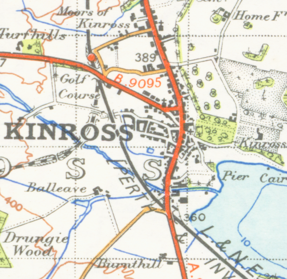
| Tuairisgeul | map of Kinross 1 inch to the mile scale scanned at 600 DPI |
| Ceann-là | |
| Tùs | OS map stirling and Dunfermline sheet 67 1945 |
| Ùghdar | OS |
Eachdraidh an fhaidhle
Briog air ceann-là/àm gus am faidhle a shealltainn mar a nochd e aig an àm sin.
| Ceann-là/Àm | Dealbhag | Meud | Cleachdaiche | Beachd | |
|---|---|---|---|---|---|
| làithreach | 01:16, 24 dhen Ghiblean 2007 | | 961 × 933 (1.72 MB) | Geni | {{oldOS}} {{Information |Description=map of Kinross 1 inch to the mile scale scanned at 600 DPI |Source=OS map stirling and Dunfermline sheet 67 1945 |Date=1945 |Author=OS |Permission=none needed |other_versions= }} |
Cleachdadh an fhaidhle
Tha ceangal ris an fhaidhle seo san duilleag a leanas:
Cleachdadh fhaidhlichean uile-choitcheann
Tha na uicidhean eile a leanas a’ cleachdadh an fhaidhle seo
- Cleachdadh air af.wikipedia.org
- Cleachdadh air ceb.wikipedia.org
- Cleachdadh air en.wikipedia.org
- Cleachdadh air it.wikipedia.org
- Cleachdadh air sv.wikipedia.org