
Faidhle:Cilthriew, Kerry, (Montgomeryshire) 16.JPG
Meud an ro-sheallaidh seo: 800 × 498 piogsail. Dùmhlachdan-breacaidh eile: 320 × 199 piogsail | 640 × 398 piogsail | 1,024 × 638 piogsail | 1,545 × 962 piogsail.
Am faidhle tùsail (1,545 × 962 pixel, meud an fhaidhle: 753 KB, seòrsa MIME: image/jpeg)
_16.JPG)
Gearr-chunntas
| Tuairisgeul |
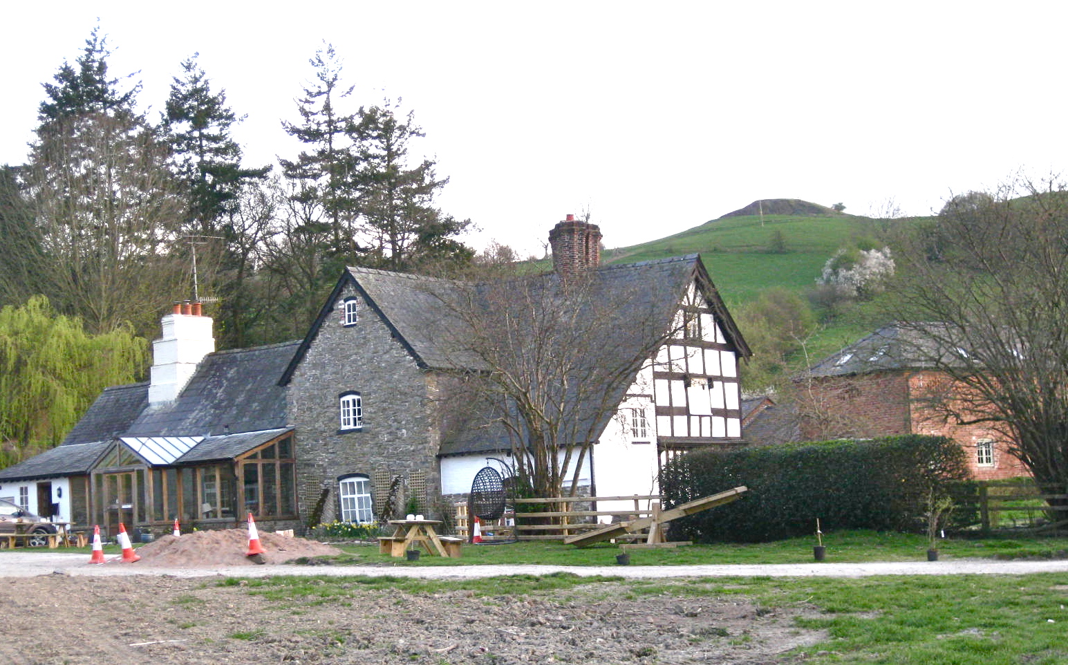
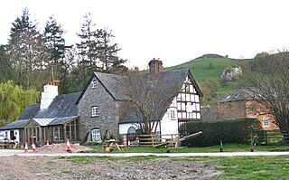
English: Cilthriew, Kerry, (Montgomeryshire) |
| Ceann-là | |
| Tùs | M’ obair fhèin |
| Ùghdar | Tyssil |
| Camera location | | View this and other nearby images on: OpenStreetMap |
|---|
_16.JPG¶ms=052.489732_N_-003.241541_E_globe:Earth_type:camera__&language=gd)
‘’‘Cilthriew’’’ is a Grade II listed house and former farm in Kerry, in the historic county of Montgomeryshire, now Powys. Presently it is used by the Papworth Trust[1] which providing a range of high quality services for disabled and disadvantaged people. Cilthriew (referred as Kerry Farm) provides free short breaks for disabled people and their families in a farm surrounding.[2]
Ceadachadh
I, the copyright holder of this work, hereby publish it under the following license:
Tha am faidhle seo fo cheadachas Creative Commons Attribution-Share Alike 3.0 Unported.
- Faodaidh tu:
- a cho-roinneadh – lethbhreac a dhèanamh dhen obair, a sgaoileadh is a tar-chur
- ath-mheasgachadh – an obair atharrachadh
- Fo bhuaidh nan cumhaichean a leanas:
- urram – Feumaidh tu iomradh a thoirt air an ùghdar no an neach aig a bheil cead air, dìreach mar a thoill iad (ach chan ann air dòigh a chuireas an sùilean dhaoine gu bheil iad ag aontachadh riut no ri d’ obair).
- co-roinneadh co-ionnann – Ma dh’atharraicheas tu no ma leasaicheas tu an obair seo, ’s urrainn an tionndadh ùr fon cheadachas seo no fo cheadachas coltach ris.
- ↑ http://www.papworth.org.uk/page.php?urlid=about_us,/
- ↑ Archive copy. Archived from the original on 2014-04-21. Retrieved on 2014-04-20.
Eachdraidh an fhaidhle
Briog air ceann-là/àm gus am faidhle a shealltainn mar a nochd e aig an àm sin.
| Ceann-là/Àm | Dealbhag | Meud | Cleachdaiche | Beachd | |
|---|---|---|---|---|---|
| làithreach | 21:48, 20 dhen Ghiblean 2014 | | 1,545 × 962 (753 KB) | Tyssil | User created page with UploadWizard |
Cleachdadh an fhaidhle
Tha ceangal ris an fhaidhle seo san duilleag a leanas:
Cleachdadh fhaidhlichean uile-choitcheann
Tha na uicidhean eile a leanas a’ cleachdadh an fhaidhle seo
- Cleachdadh air ceb.wikipedia.org
- Cleachdadh air en.wikipedia.org
- Cleachdadh air kw.wikipedia.org
- Cleachdadh air www.wikidata.org
_16.JPG)