
Faidhle:Bonnybridge Terraces - geograph.org.uk - 138508.jpg
Chan eil dùmhlachd-bhreacaidh nas fhearr ri fhaighinn.
Bonnybridge_Terraces_-_geograph.org.uk_-_138508.jpg (640 × 480 pixel, meud an fhaidhle: 284 KB, seòrsa MIME: image/jpeg)
Gearr-chunntas
| Tuairisgeul |
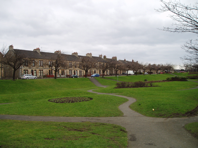
English: Bonnybridge Terraces. These 19th Century houses beside a picturesque park in the heart of this industrial town which lies on the Bonny Water. The town developed in the 19th century in association with a Saw Mill and Paper Mill and Iron Foundries which used the river and the nearby Forth and Clyde Canal. |
| Ceann-là | |
| Tùs | From geograph.org.uk |
| Ùghdar | Kevin Rae |
| Urram (required by the license) | Kevin Rae / Bonnybridge Terraces / |
| Camera location | | View this and other nearby images on: OpenStreetMap |
|---|
_&language=gd)
| Object location | | View this and other nearby images on: OpenStreetMap |
|---|
_&language=gd)
Ceadachadh

|
This image was taken from the Geograph project collection. See this photograph's page on the Geograph website for the photographer's contact details. The copyright on this image is owned by Kevin Rae and is licensed for reuse under the Creative Commons Attribution-ShareAlike 2.0 license.
|
This file is licensed under the Creative Commons Attribution-Share Alike 2.0 Generic license.
Urram: Kevin Rae
- Faodaidh tu:
- a cho-roinneadh – lethbhreac a dhèanamh dhen obair, a sgaoileadh is a tar-chur
- ath-mheasgachadh – an obair atharrachadh
- Fo bhuaidh nan cumhaichean a leanas:
- urram – Feumaidh tu iomradh a thoirt air an ùghdar no an neach aig a bheil cead air, dìreach mar a thoill iad (ach chan ann air dòigh a chuireas an sùilean dhaoine gu bheil iad ag aontachadh riut no ri d’ obair).
- co-roinneadh co-ionnann – Ma dh’atharraicheas tu no ma leasaicheas tu an obair seo, ’s urrainn an tionndadh ùr fon cheadachas seo no fo cheadachas coltach ris.
Eachdraidh an fhaidhle
Briog air ceann-là/àm gus am faidhle a shealltainn mar a nochd e aig an àm sin.
| Ceann-là/Àm | Dealbhag | Meud | Cleachdaiche | Beachd | |
|---|---|---|---|---|---|
| làithreach | 03:20, 31 dhen Fhaoilleach 2010 | | 640 × 480 (284 KB) | GeographBot | == {{int:filedesc}} == {{Information |description={{en|1=Bonnybridge Terraces. These 19th Century houses beside a picturesque park in the heart of this industrial town which lies on the Bonny Water. The town developed in the 19th century in association wi |
Cleachdadh an fhaidhle
Tha ceangal ris an fhaidhle seo san duilleag a leanas:
Cleachdadh fhaidhlichean uile-choitcheann
Tha na uicidhean eile a leanas a’ cleachdadh an fhaidhle seo
- Cleachdadh air af.wikipedia.org
- Cleachdadh air en.wikipedia.org
- Cleachdadh air fa.wikipedia.org
- Cleachdadh air ru.wikipedia.org
- Cleachdadh air sco.wikipedia.org
- Cleachdadh air sv.wikipedia.org