
Faidhle:Barra Satellite Photo.png

Meud an ro-sheallaidh seo: 800 × 564 piogsail. Dùmhlachdan-breacaidh eile: 320 × 226 piogsail | 640 × 451 piogsail | 1,024 × 722 piogsail.
Am faidhle tùsail (1,024 × 722 pixel, meud an fhaidhle: 966 KB, seòrsa MIME: image/png)
Gearr-chunntas
| Tuairisgeul |
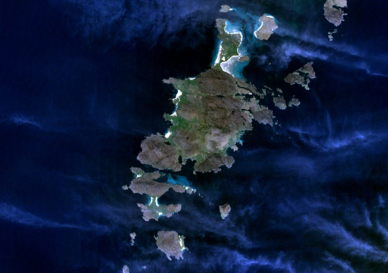
English: Satellite view of Barra surrounded by Vatersay, Sandray to the south, and Hellisay, Gighay and Fuday to the north. |
| Ceann-là | 6 dhen Fhaoilleach 2007 (upload date) |
| Tùs | Satellite imagery taken from NASA World Wind software (by screenshot) |
| Ùghdar | NASA |
Ceadachadh
| This image is in the public domain because it is a screenshot from NASA’s globe software World Wind using a public domain layer, such as Blue Marble, MODIS, Landsat, SRTM, USGS or GLOBE.
|
 |
Eachdraidh an fhaidhle
Briog air ceann-là/àm gus am faidhle a shealltainn mar a nochd e aig an àm sin.
| Ceann-là/Àm | Dealbhag | Meud | Cleachdaiche | Beachd | |
|---|---|---|---|---|---|
| làithreach | 23:42, 6 dhen Fhaoilleach 2007 | | 1,024 × 722 (966 KB) | JamesMorrison | Screenrab from NASA World Wind of Barra |
Cleachdadh an fhaidhle
Tha ceangal ris an fhaidhle seo san duilleag a leanas:
Cleachdadh fhaidhlichean uile-choitcheann
Tha na uicidhean eile a leanas a’ cleachdadh an fhaidhle seo
- Cleachdadh air br.wikipedia.org
- Cleachdadh air el.wikipedia.org
- Cleachdadh air en.wikipedia.org
- Cleachdadh air es.wikipedia.org
- Cleachdadh air eu.wikipedia.org
- Cleachdadh air fr.wikipedia.org
- Cleachdadh air hu.wikipedia.org
- Cleachdadh air it.wikipedia.org
- Cleachdadh air nn.wikipedia.org
- Cleachdadh air no.wikipedia.org
- Cleachdadh air pl.wikipedia.org
- Cleachdadh air ru.wikipedia.org
- Cleachdadh air sr.wikipedia.org
- Cleachdadh air sv.wikipedia.org
- Cleachdadh air zh.wikipedia.org