
Faidhle:AnnapolisRoyalNSSkyline.jpg
Meud an ro-sheallaidh seo: 800 × 302 piogsail. Dùmhlachdan-breacaidh eile: 320 × 121 piogsail | 640 × 241 piogsail | 1,600 × 603 piogsail.
Am faidhle tùsail (1,600 × 603 pixel, meud an fhaidhle: 321 KB, seòrsa MIME: image/jpeg)
Gearr-chunntas
| Camera location | | View this and other nearby images on: OpenStreetMap |
|---|
| Tuairisgeul |
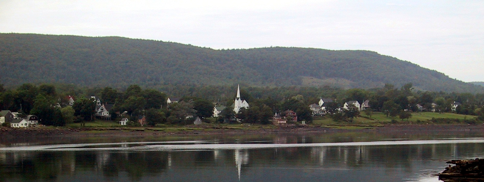
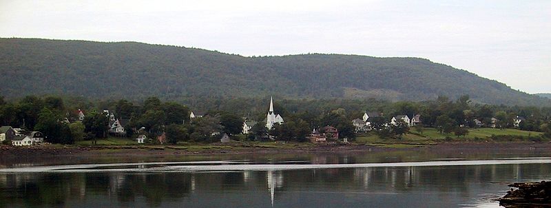
English: Granville Ferry, Nova Scotia, Canada skyline Français : La silhouette d'Annapolis Royal, Nouvelle-Écosse, Canada |
| Ceann-là | |
| Tùs | M’ obair fhèin |
| Ùghdar | Whpq |
| Other versions |
.jpg)
Ceadachadh
I, the copyright holder of this work, hereby publish it under the following licenses:

|
Permission is granted to copy, distribute and/or modify this document under the terms of the GNU Free Documentation License, Version 1.2 or any later version published by the Free Software Foundation; with no Invariant Sections, no Front-Cover Texts, and no Back-Cover Texts. A copy of the license is included in the section entitled GNU Free Documentation License. |
| Tha am faidhle seo fo cheadachas Creative Commons Attribution-Share Alike 3.0 Unported. | ||
| ||
| This licensing tag was added to this file as part of the GFDL licensing update. |
’S urrainn dhut an ceadachas as fhearr leat a thaghadh.
Eachdraidh an fhaidhle
Briog air ceann-là/àm gus am faidhle a shealltainn mar a nochd e aig an àm sin.
| Ceann-là/Àm | Dealbhag | Meud | Cleachdaiche | Beachd | |
|---|---|---|---|---|---|
| làithreach | 22:33, 4 dhen Iuchar 2010 | 1,600 × 603 (321 KB) | Jeangagnon | photoshop | |
| 16:42, 3 dhen Fhaoilleach 2008 | 1,600 × 603 (288 KB) | Whpq | {{location dec|44.74039314152228|-65.49619674682617}} {{Information |Description={{en|Annapolis Royal, Nova Scotia, Canada skyline}} |Source=self-made |Date=2005-08-14 |Author= Whpq |Permission= |other_versions= }} |
Cleachdadh an fhaidhle
Tha ceangal ris an fhaidhle seo sna duilleagan a leanas:
Cleachdadh fhaidhlichean uile-choitcheann
Tha na uicidhean eile a leanas a’ cleachdadh an fhaidhle seo
- Cleachdadh air ar.wikipedia.org
- Cleachdadh air arz.wikipedia.org
- Cleachdadh air atj.wikipedia.org
- Cleachdadh air ca.wikipedia.org
- Cleachdadh air ceb.wikipedia.org
- Cleachdadh air cs.wikipedia.org
- Cleachdadh air cv.wikipedia.org
- Cleachdadh air de.wikipedia.org
- Cleachdadh air en.wikipedia.org
- Cleachdadh air en.wikivoyage.org
- Cleachdadh air es.wikipedia.org
- Cleachdadh air et.wikipedia.org
- Cleachdadh air fr.wikipedia.org
- Cleachdadh air fr.wikivoyage.org
- Cleachdadh air it.wikipedia.org
- Cleachdadh air lld.wikipedia.org
- Cleachdadh air pl.wikipedia.org
- Cleachdadh air pt.wikipedia.org
- Cleachdadh air ro.wikipedia.org
- Cleachdadh air ru.wikipedia.org
- Cleachdadh air sk.wikipedia.org
- Cleachdadh air sq.wikipedia.org
- Cleachdadh air sv.wikipedia.org
- Cleachdadh air uk.wikipedia.org
- Cleachdadh air www.wikidata.org
- Cleachdadh air zh.wikipedia.org