
Faidhle:1761 Homann Heirs Map of Iceland "Insulae Islandiae" - Geographicus - Islandiae-hmhr-1761.jpg
Meud an ro-sheallaidh seo: 745 × 600 piogsail. Dùmhlachdan-breacaidh eile: 298 × 240 piogsail | 597 × 480 piogsail | 954 × 768 piogsail | 1,272 × 1,024 piogsail | 2,500 × 2,012 piogsail.
Am faidhle tùsail (2,500 × 2,012 pixel, meud an fhaidhle: 1.58 MB, seòrsa MIME: image/jpeg)
| Insuale Islandiae | ||||||
|---|---|---|---|---|---|---|
| Artist | ||||||
| Title |
Insuale Islandiae |
|||||
| Tuairisgeul |
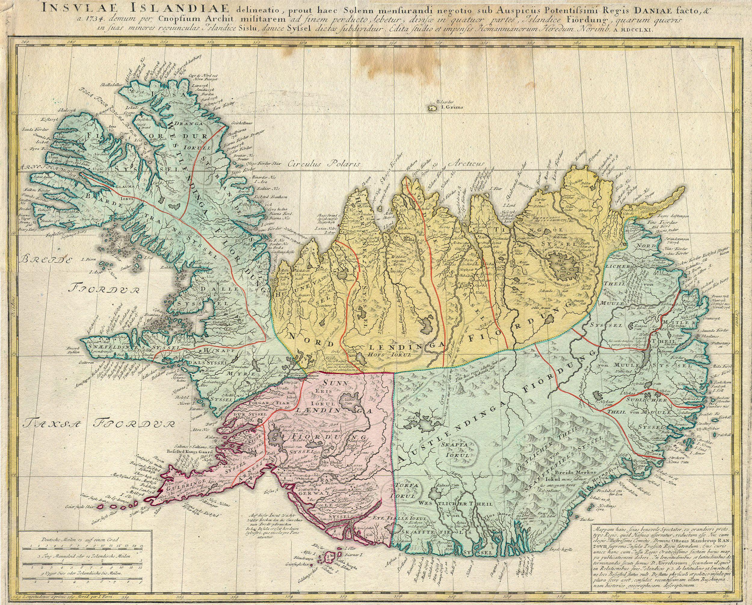
English: This is a rare and spectacular 1761 Homann Heirs map depicting Iceland. Fine map of this region compiled according to Danish surveys. Lovers of Icelandic sagas will recognize many of the towns and cities noted. |
|||||
| Ceann-là | 1761 | |||||
| Dimensions | àirde: 19 in (48.2 cm); width: 21.5 in (54.6 cm) | |||||
| Accession number |
Geographicus link: Islandiae-hmhr-1761 |
|||||
| Source/Photographer |
|
|||||
| Cead (Ag ath-chleachdadh an fhaidhle seo) |
|
|||||
Eachdraidh an fhaidhle
Briog air ceann-là/àm gus am faidhle a shealltainn mar a nochd e aig an àm sin.
| Ceann-là/Àm | Dealbhag | Meud | Cleachdaiche | Beachd | |
|---|---|---|---|---|---|
| làithreach | 10:03, 24 dhen Mhàrt 2011 | | 2,500 × 2,012 (1.58 MB) | BotMultichillT | {{subst:User:Multichill/Geographicus |link=http://www.geographicus.com/P/AntiqueMap/Islandiae-hmhr-1761 |product_name=1761 Homann Heirs Map of Iceland "Insulae Islandiae" |map_title=Insuale Islandiae |description=This is a rare and spectacular 1761 Homann |
Cleachdadh an fhaidhle
Tha ceangal ris an fhaidhle seo san duilleag a leanas:
Cleachdadh fhaidhlichean uile-choitcheann
Tha na uicidhean eile a leanas a’ cleachdadh an fhaidhle seo
- Cleachdadh air ar.wikipedia.org
- Cleachdadh air be-tarask.wikipedia.org
- Cleachdadh air be.wikipedia.org
- Cleachdadh air br.wikipedia.org
- Cleachdadh air ca.wikipedia.org
- Cleachdadh air da.wikipedia.org
- Cleachdadh air da.wikibooks.org
- Cleachdadh air de.wikipedia.org
- Cleachdadh air en.wikipedia.org
- Cleachdadh air es.wikipedia.org
- Cleachdadh air fr.wikipedia.org
- Cleachdadh air gl.wikipedia.org
- Cleachdadh air hu.wikipedia.org
- Cleachdadh air is.wikipedia.org
- Cleachdadh air ja.wikipedia.org
- Cleachdadh air ko.wikipedia.org
- Cleachdadh air nl.wikipedia.org
- Cleachdadh air pt.wikipedia.org
- Cleachdadh air ru.wikipedia.org
- Cleachdadh air sv.wikipedia.org
- Cleachdadh air uk.wikipedia.org