
Faidhle:Scotland relief location map.jpg

Meud an ro-sheallaidh seo: 456 × 600 piogsail. Dùmhlachdan-breacaidh eile: 182 × 240 piogsail | 365 × 480 piogsail | 584 × 768 piogsail | 1,128 × 1,483 piogsail.
Am faidhle tùsail (1,128 × 1,483 pixel, meud an fhaidhle: 927 KB, seòrsa MIME: image/jpeg)
Gearr-chunntas
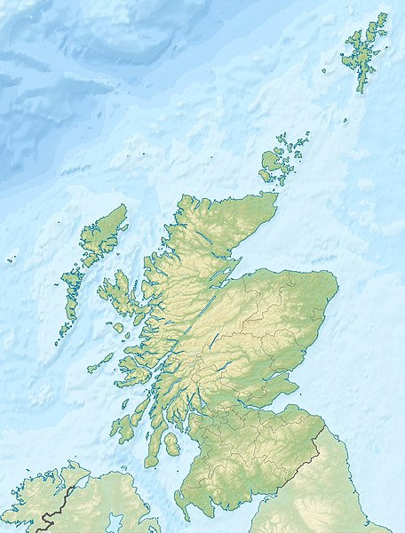
| Tuairisgeul | Quadratische Plattkarte, N-S-Streckung 170 %. Geographische Begrenzung der Karte: * N: 61.0° N * S: 54.5° N * W: 8.8° W * O: 0.4° W Equirectangular projection, N/S stretching 170 %. Geographic limits of the map: * N: 61.0° N * S: 54.5° N * W: 8.8° W * E: 0.4° W |
| Ceann-là | (UTC) |
| Tùs | M’ obair fhèin |
| Ùghdar |
|
| Other versions |
|

Ceadachadh
I, the copyright holder of this work, hereby publish it under the following licenses:
Tha am faidhle seo fo cheadachas Creative Commons Attribution-Share Alike 3.0 Unported.
Urram: Eric Gaba, NordNordWest, Uwe Dedering
- Faodaidh tu:
- a cho-roinneadh – lethbhreac a dhèanamh dhen obair, a sgaoileadh is a tar-chur
- ath-mheasgachadh – an obair atharrachadh
- Fo bhuaidh nan cumhaichean a leanas:
- urram – Feumaidh tu iomradh a thoirt air an ùghdar no an neach aig a bheil cead air, dìreach mar a thoill iad (ach chan ann air dòigh a chuireas an sùilean dhaoine gu bheil iad ag aontachadh riut no ri d’ obair).
- co-roinneadh co-ionnann – Ma dh’atharraicheas tu no ma leasaicheas tu an obair seo, ’s urrainn an tionndadh ùr fon cheadachas seo no fo cheadachas coltach ris.

|
Permission is granted to copy, distribute and/or modify this document under the terms of the GNU Free Documentation License, Version 1.2 or any later version published by the Free Software Foundation; with no Invariant Sections, no Front-Cover Texts, and no Back-Cover Texts. A copy of the license is included in the section entitled GNU Free Documentation License. |
’S urrainn dhut an ceadachas as fhearr leat a thaghadh.
Original upload log
This image is a derivative work of the following images:
- File:Scotland_location_map.svg licensed with Cc-by-sa-3.0, GFDL
- 2008-10-09T18:27:35Z NordNordWest 1128x1483 (829918 Bytes) {{Information |Description= {{de|Positionskarte von [[:de:Schottland|Schottland]], [[:de:Vereinigtes Königreich|Vereinigtes Königreich]]}} Quadratische Plattkarte, N-S-Streckung 170 %. Geographische Begrenzung der Karte: *
Uploaded with derivativeFX
Eachdraidh an fhaidhle
Briog air ceann-là/àm gus am faidhle a shealltainn mar a nochd e aig an àm sin.
| Ceann-là/Àm | Dealbhag | Meud | Cleachdaiche | Beachd | |
|---|---|---|---|---|---|
| làithreach | 23:30, 25 dhen Ògmhios 2010 | | 1,128 × 1,483 (927 KB) | Uwe Dedering | {{Information |Description={{de|Positionskarte von Schottland, Vereinigtes Königreich}} Quadratische Plattkarte, N-S-Streckung 170 %. Geographische Begrenzung der Karte: * N: 61.0° N * S: 54.5° N * W: |
Cleachdadh an fhaidhle
Tha ceangal ris an fhaidhle seo ann am barrachd air 100 duilleag. Cha sheall an liosta a leanas ach a' chiad 100 duilleag sa bheil ceangal ris an fhaidhle seo. Tha liosta shlàn ri fhaighinn.
- A' Bhòrlainn
- A' Chananaich
- A' Chrìon-Làraich
- A' Mhanachainn
- Alanais
- An Aghaidh Mhòr
- An Eaglais Bhreac
- An Geal Àth
- An Gearasdan
- An Leargaidh
- An Truthail
- An Tòb
- Armadal
- Baile Bhòid
- Baile Dhubhthaich
- Baile Dhunlèibhe
- Baile Eòghainn
- Baile Iain
- Baile nam Feusgan
- Baile nam Frisealach
- Baile Ùr an t-Slèibh
- Bealadair
- Bearsden
- Beinn Dòbhrain
- Beinn Hòb
- Beinn Nibheis
- Beithe
- Blantaidhr
- Bogh Mòr
- Breichin
- Brùra
- Bàgh a' Chaisteil
- Caladar an Iar
- Cas Chaolais
- Ceann Chàrdainn, Fìobha
- Cill Mhàrais
- Cill Saidh
- Cille Bhrìghde an Ear
- Cille Chuimein
- Cille Chùithbeirt
- Cille Mhàrtainn
- Claonaig
- Cnoc a' Bharra
- Comar nan Allt
- Comaraidh
- Cromba
- Cupar Fìobha
- Càrn Rìoghain
- Cùil Lodair
- Dairbheal
- Dolair
- Druiminn
- Dùn Bhlàthain
- Dùn Breatann
- Dùn Bàrr
- Dùn Dèagh
- Dùn Omhain
- Dùn Èideann
- Ealaghol
- Eilginn
- Geàrrloch
- Glamaig
- Glaschu
- Gleann Fhionnainn
- Gleann Gairneig
- Gleann Rathais
- Goillspidh
- Grianaig
- Hunndaidh
- Inbhir Ghòrdain
- Inbhir Narann
- Inbhir Nis
- Inbhir Pheofharain
- Inbhir Theòrsa
- Inbhir Ùige
- Irbhinn
- Loch Ceiteirein
- Loch nam Madadh
- Maghlinn
- Malaig
- Maybole
- Mos Tudlach
- Obar Chiardair
- Obar Dheathain
- Poll-Mhonadh
- Port Bhruachaidh
- Port na Banrighinn a Tuath
- Pàislig
- Rinn Friù
- Ros Abhartaich
- Ros Maircnidh
- Sruighlea
- Tairbeart na Hearadh
- Tarbolton
- Tobar na Màthar
- Toirbheartan
- Uaimh, Siorrachd Pheairt
- Ulapul
- Urchard
- Whithorn
Seall barrachd cheanglaichean gun fhaidhle seo.
Cleachdadh fhaidhlichean uile-choitcheann
Tha na uicidhean eile a leanas a’ cleachdadh an fhaidhle seo
- Cleachdadh air ab.wikipedia.org
- Cleachdadh air am.wikipedia.org
- Cleachdadh air ar.wikipedia.org
- Cleachdadh air arz.wikipedia.org
- Cleachdadh air ast.wikipedia.org
- Cleachdadh air as.wikipedia.org
- Cleachdadh air awa.wikipedia.org
- Cleachdadh air azb.wikipedia.org
- Cleachdadh air az.wikipedia.org
- Cleachdadh air ba.wikipedia.org
- Cleachdadh air be-tarask.wikipedia.org
- Cleachdadh air be.wikipedia.org
Seall an corr dhen chleachdadh uile-choitcheann a nithear dhen fhaidhle seo.