
Faidhle:Position of Tasman Region.png
Chan eil dùmhlachd-bhreacaidh nas fhearr ri fhaighinn.
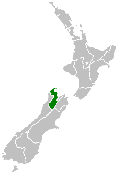
Position_of_Tasman_Region.png (405 × 590 pixel, meud an fhaidhle: 7 KB, seòrsa MIME: image/png)
Region of New Zealand, position on the map (source:English Wiki)
| |
This work has been released into the public domain by its author, Furius, at the Beurla Uicipeid project. This applies worldwide. In case this is not legally possible: |
Eachdraidh an fhaidhle
Briog air ceann-là/àm gus am faidhle a shealltainn mar a nochd e aig an àm sin.
| Ceann-là/Àm | Dealbhag | Meud | Cleachdaiche | Beachd | |
|---|---|---|---|---|---|
| làithreach | 07:41, 27 dhen Ghiblean 2005 | | 405 × 590 (7 KB) | Domie~commonswiki | Region of New Zealand, position on the map (source:English Wiki) {{PD}} Category:Maps of New Zealand |
Cleachdadh an fhaidhle
Tha ceangal ris an fhaidhle seo san duilleag a leanas:
Cleachdadh fhaidhlichean uile-choitcheann
Tha na uicidhean eile a leanas a’ cleachdadh an fhaidhle seo
- Cleachdadh air en.wikipedia.org
- Lake Rotoroa (Tasman)
- Mount Owen (New Zealand)
- Rotoroa, New Zealand
- Kahurangi Point
- Bulmer Cavern
- Cape Farewell, New Zealand
- Lake Matiri
- Abel Tasman Inland Track
- Template:Tasman-geo-stub
- Lake Constance (New Zealand)
- Saint Arnaud Range
- Lake Sparrow
- Granity Pass
- Matiri Project
- Spenser Mountains
- Sabine Valley
- User:MSGJ/Wairoa River, Tasman
- Hope Saddle
- Ellis Basin cave system
- Waimea County
- Takaka County
- Mount Franklin (Tasman)
- Split Apple Rock
- Tinline Bay
- Motuareronui / Adele Island
- Tonga Island
- Bronte, New Zealand
- Pūponga
- Ngārua Caves
- Woodstock, Tasman
- Waimea Inlet
- Murchison County, New Zealand
- Golden Bay County
- Collingwood County
- Golden Bay Ward
- Lakes-Murchison Ward
- Motueka Ward
- Moutere-Waimea Ward
- Richmond Ward
- Motupipi
- Dovedale, New Zealand
- Mahana, New Zealand
- Rotoiti Mainland Island
- Patons Rock
- Upper Tākaka
- Bell Island (New Zealand)
- Armchair Island
- Ballon Rock
- Bird Island (Tasman Region)
- Awaroa River (Tasman)
Seall an corr dhen chleachdadh uile-choitcheann a nithear dhen fhaidhle seo.