
Faidhle:Orienteringskort bygholm 2005.PNG

Meud an ro-sheallaidh seo: 800 × 498 piogsail. Dùmhlachdan-breacaidh eile: 320 × 199 piogsail | 640 × 399 piogsail | 1,024 × 638 piogsail | 1,280 × 797 piogsail | 2,335 × 1,454 piogsail.
Am faidhle tùsail (2,335 × 1,454 pixel, meud an fhaidhle: 3.64 MB, seòrsa MIME: image/png)
Gearr-chunntas
| Tuairisgeul |
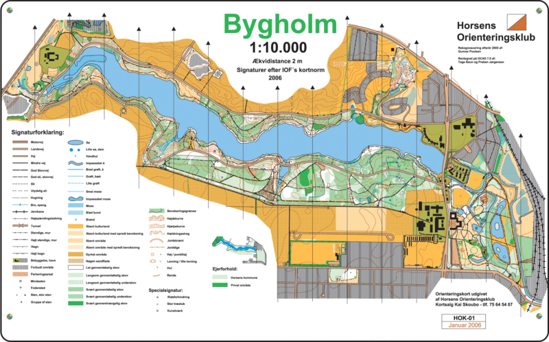
English: Orienteering map of "Bygholm Skov" just outside Horsens, Denmark. Map uploaded with permission from Horsens Orienteringsklub, c/o chairman Lars Sørensen.
Dansk: Orienteringskort (o-kort) over Bygholm Skov ved Horsens. Uploadet med tilladelse fra Horsens Orienteringsklub, v/ fmd. Lars Sørensen. Rekognosceret af Gunnar Poulsen. Tegnet af Tage Baun og Preben Jørgensen.
Polski: Przykład mapy do biegu na orientację z okolic Horsens, Dania. |
| Tùs | Horsens Orienteringsklub |
| Ùghdar | Tage Baun and Preben Jørgensen |
Ceadachadh

|
Permission is granted to copy, distribute and/or modify this document under the terms of the GNU Free Documentation License, Version 1.2 or any later version published by the Free Software Foundation; with no Invariant Sections, no Front-Cover Texts, and no Back-Cover Texts. A copy of the license is included in the section entitled GNU Free Documentation License. |
| Tha am faidhle seo fo cheadachas Creative Commons Attribution-Share Alike 3.0 Unported. | ||
| ||
| This licensing tag was added to this file as part of the GFDL licensing update. |
(usuń) (bież) 12:49, 28 II 2006 . . Ernst Poulsen (Dyskusja | wkład) . . 2335×1454 (1 287 161 bajtów) (Orienteringskort (o-kort) over Bygholm Skov ved Horsens. Uploadet med tilladelse fra Horsens Orienteringsklub, v/ fmd. Lars Sørensen. Rekognosceret af Gunnar Poulsen. Tegnet af Tage Baun og Preben Jørgensen. Orienteering map of "Bygholm Skov" just outs)
Eachdraidh an fhaidhle
Briog air ceann-là/àm gus am faidhle a shealltainn mar a nochd e aig an àm sin.
| Ceann-là/Àm | Dealbhag | Meud | Cleachdaiche | Beachd | |
|---|---|---|---|---|---|
| làithreach | 17:28, 26 dhen Dùbhlachd 2006 | | 2,335 × 1,454 (3.64 MB) | Szczepan1990 | == Summary == da: Orienteringskort (o-kort) over Bygholm Skov ved Horsens. Uploadet med tilladelse fra Horsens Orienteringsklub, v/ fmd. Lars Sørensen. Rekognosceret af Gunnar Poulsen. Tegnet af Tage Baun og Preben Jørgensen. en: Orienteering map o |
Cleachdadh an fhaidhle
Tha ceangal ris an fhaidhle seo san duilleag a leanas:
Cleachdadh fhaidhlichean uile-choitcheann
Tha na uicidhean eile a leanas a’ cleachdadh an fhaidhle seo
- Cleachdadh air az.wikipedia.org
- Cleachdadh air ba.wikipedia.org
- Cleachdadh air be.wikipedia.org
- Cleachdadh air ca.wikipedia.org
- Cleachdadh air cs.wikipedia.org
- Cleachdadh air da.wikipedia.org
- Cleachdadh air da.wikibooks.org
- Cleachdadh air en.wikipedia.org
- Cleachdadh air eu.wikipedia.org
- Cleachdadh air fi.wikipedia.org
- Cleachdadh air fi.wiktionary.org
- Cleachdadh air hr.wikipedia.org
- Cleachdadh air kk.wikipedia.org
- Cleachdadh air lt.wikipedia.org
- Cleachdadh air pl.wikipedia.org
- Cleachdadh air ro.wikipedia.org
- Cleachdadh air ru.wikipedia.org
- Cleachdadh air tr.wikipedia.org
- Cleachdadh air tt.wikipedia.org
- Cleachdadh air uk.wikipedia.org
- Cleachdadh air vi.wikipedia.org
- Cleachdadh air www.wikidata.org
- Cleachdadh air zh-yue.wikipedia.org
- Cleachdadh air zh.wikipedia.org