
Faidhle:Map of Florida highlighting Fort Lauderdale.svg

Size of this PNG preview of this SVG file: 450 × 429 piogsail. Dùmhlachdan-breacaidh eile: 252 × 240 piogsail | 504 × 480 piogsail | 806 × 768 piogsail | 1,074 × 1,024 piogsail | 2,148 × 2,048 piogsail.
Am faidhle tùsail (Faidhle SVG, a-rèir ainm 450 × 429 pixel, meud faidhle: 1.17 MB)
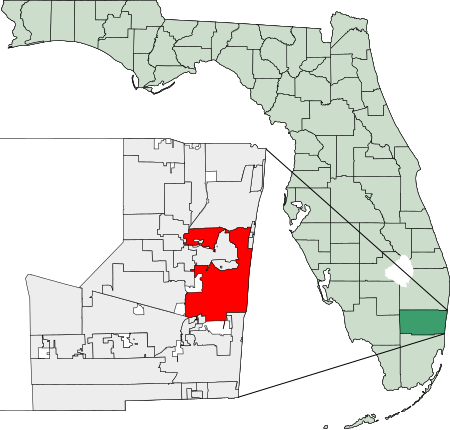
26°08′09″N 80°08′31″W / 26.13583°N 80.14194°W
Created using coordinate data from US Census Bureau, modified in accordance with incorporation data from 2000-2005 in Adobe Illustrator. Now redrawn in Inkscape.

|
Permission is granted to copy, distribute and/or modify this document under the terms of the GNU Free Documentation License, Version 1.2 or any later version published by the Free Software Foundation; with no Invariant Sections, no Front-Cover Texts, and no Back-Cover Texts. A copy of the license is included in the section entitled GNU Free Documentation License. |
| Tha am faidhle seo fo cheadachas Creative Commons Attribution-Share Alike 3.0 Unported. | ||
| ||
| This licensing tag was added to this file as part of the GFDL licensing update. |
Eachdraidh an fhaidhle
Briog air ceann-là/àm gus am faidhle a shealltainn mar a nochd e aig an àm sin.
| Ceann-là/Àm | Dealbhag | Meud | Cleachdaiche | Beachd | |
|---|---|---|---|---|---|
| làithreach | 03:23, 28 dhen Ghearran 2007 | | 450 × 429 (1.17 MB) | Bastique | {{coor dms|26|08|09|N|80|08|31|W|}} Created using coordinate data from US Census Bureau, modified in accordance with incorporation data from 2000-2005 in Adobe Illustrator. {{GDFL}} [[Category:Maps of Broward County, |
Cleachdadh an fhaidhle
Tha ceangal ris an fhaidhle seo san duilleag a leanas:
Cleachdadh fhaidhlichean uile-choitcheann
Tha na uicidhean eile a leanas a’ cleachdadh an fhaidhle seo
- Cleachdadh air af.wikipedia.org
- Cleachdadh air ar.wikipedia.org
- Cleachdadh air arz.wikipedia.org
- Cleachdadh air ast.wikipedia.org
- Cleachdadh air azb.wikipedia.org
- Cleachdadh air ba.wikipedia.org
- Cleachdadh air ca.wikipedia.org
- Cleachdadh air ceb.wikipedia.org
- Cleachdadh air cy.wikipedia.org
- Cleachdadh air el.wikipedia.org
- Cleachdadh air en.wikinews.org
- Cleachdadh air eo.wikipedia.org
- Cleachdadh air es.wikipedia.org
- Cleachdadh air et.wikipedia.org
- Cleachdadh air eu.wikipedia.org
- Cleachdadh air fa.wikipedia.org
- Cleachdadh air fr.wikipedia.org
- Cleachdadh air fy.wikipedia.org
- Cleachdadh air ga.wikipedia.org
- Cleachdadh air gl.wikipedia.org
- Cleachdadh air he.wikipedia.org
- Cleachdadh air ht.wikipedia.org
- Cleachdadh air hu.wikipedia.org
- Cleachdadh air ia.wikipedia.org
- Cleachdadh air it.wikipedia.org
- Cleachdadh air ja.wikipedia.org
- Cleachdadh air ko.wikipedia.org
- Cleachdadh air kw.wikipedia.org
- Cleachdadh air la.wikipedia.org
- Cleachdadh air lb.wikipedia.org
- Cleachdadh air mdf.wikipedia.org
- Cleachdadh air ml.wikipedia.org
- Cleachdadh air nn.wikipedia.org
- Cleachdadh air ro.wikipedia.org
- Cleachdadh air sco.wikipedia.org
- Cleachdadh air simple.wikipedia.org
- Cleachdadh air th.wikipedia.org
- Cleachdadh air tr.wikipedia.org
- Cleachdadh air tt.wikipedia.org
- Cleachdadh air ur.wikipedia.org
- Cleachdadh air vo.wikipedia.org
- Cleachdadh air www.wikidata.org