
Faidhle:Locationmap Korea.png
Chan eil dùmhlachd-bhreacaidh nas fhearr ri fhaighinn.
Locationmap_Korea.png (250 × 115 pixel, meud an fhaidhle: 5 KB, seòrsa MIME: image/png)
Gearr-chunntas
| Tuairisgeul |
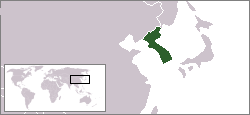
English: The location of the Korean peninsula. |
|||
| Ceann-là | 16 dhen Lùnastal 2004 (original upload date) | |||
| Tùs | This map was created using the existing Image:LocationSouthKorea.png contributed by User:Vardion. | |||
| Ùghdar | Kokiri at Beurla Uicipeid | |||
| Other versions |
|


Ceadachadh
| Tha am faidhle seo fo cheadachas Creative Commons Attribution-Share Alike 3.0 Unported. Subject to disclaimers. | ||
| ||
| This licensing tag was added to this file as part of the GFDL licensing update. |

|
Permission is granted to copy, distribute and/or modify this document under the terms of the GNU Free Documentation License, Version 1.2 or any later version published by the Free Software Foundation; with no Invariant Sections, no Front-Cover Texts, and no Back-Cover Texts. A copy of the license is included in the section entitled GNU Free Documentation License. Subject to disclaimers. |
Original upload log
The original description page was here. All following user names refer to en.wikipedia.
- 2007-07-20 02:50 IAMTHEEGGMAN 250×115× (4768 bytes) Updated to borders at the time...
- 2004-08-16 18:18 Kokiri 250×115× (3976 bytes) map showing location of the Korean peninsula
Eachdraidh an fhaidhle
Briog air ceann-là/àm gus am faidhle a shealltainn mar a nochd e aig an àm sin.
| Ceann-là/Àm | Dealbhag | Meud | Cleachdaiche | Beachd | |
|---|---|---|---|---|---|
| làithreach | 00:08, 30 dhen t-Sultain 2012 | | 250 × 115 (5 KB) | OgreBot | (BOT): Uploading old version of file from en.wikipedia; originally uploaded on 2007-07-20 02:50:53 by IAMTHEEGGMAN |
| 12:01, 18 dhen Ghearran 2005 |  | 250 × 115 (4 KB) | Knutux | location of the Korean peninsula. |
Cleachdadh an fhaidhle
Chan eil duilleag sam bith a' ceangal an-seo.
Cleachdadh fhaidhlichean uile-choitcheann
Tha na uicidhean eile a leanas a’ cleachdadh an fhaidhle seo
- Cleachdadh air ar.wikipedia.org
- Cleachdadh air be-tarask.wikipedia.org
- Cleachdadh air en.wikipedia.org
- Cleachdadh air et.wikipedia.org
- Cleachdadh air fy.wikipedia.org
- Cleachdadh air hr.wikipedia.org
- Cleachdadh air it.wikinews.org
- Cleachdadh air jv.wikipedia.org
- Cleachdadh air km.wikipedia.org
- Cleachdadh air ms.wikipedia.org
- Cleachdadh air nl.wikipedia.org
- Cleachdadh air ro.wikipedia.org
- Cleachdadh air sah.wikipedia.org
- Cleachdadh air sh.wikipedia.org
- Cleachdadh air tl.wikipedia.org
- Cleachdadh air uz.wikipedia.org
- Cleachdadh air wuu.wikipedia.org
- Cleachdadh air zh-classical.wikipedia.org
- Cleachdadh air zh-min-nan.wikipedia.org
- Cleachdadh air zh-yue.wikipedia.org