
Faidhle:Kenmore from Black Rock.jpg
Meud an ro-sheallaidh seo: 800 × 600 piogsail. Dùmhlachdan-breacaidh eile: 320 × 240 piogsail | 640 × 480 piogsail | 1,024 × 768 piogsail | 1,280 × 960 piogsail | 2,560 × 1,920 piogsail | 2,816 × 2,112 piogsail.
Am faidhle tùsail (2,816 × 2,112 pixel, meud an fhaidhle: 2.78 MB, seòrsa MIME: image/jpeg)
Gearr-chunntas
| Tuairisgeul |
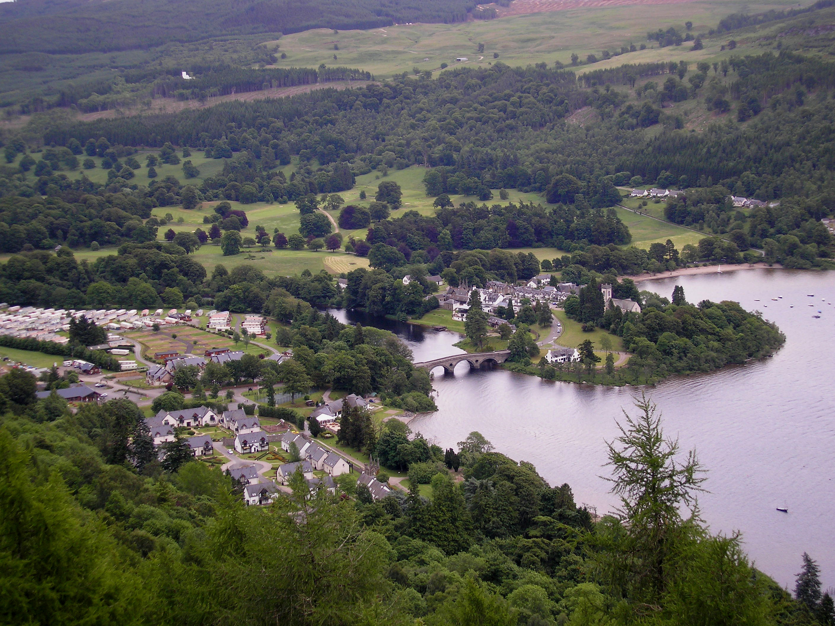
English: The village of Kenmore, Perth and Kinross, Scotland located on Loch Tay and by the emergence of the River Tay, taken from the Black Rock viewpoint. |
| Ceann-là | |
| Tùs | M’ obair fhèin |
| Ùghdar | Keith S Brown - Ksbrown |
| Camera location | | View this and other nearby images on: OpenStreetMap |
|---|
Ceadachadh
I, the copyright holder of this work, hereby publish it under the following licenses:
Tha am faidhle seo fo cheadachas Creative Commons Attribution-Share Alike 3.0 Unported.
- Faodaidh tu:
- a cho-roinneadh – lethbhreac a dhèanamh dhen obair, a sgaoileadh is a tar-chur
- ath-mheasgachadh – an obair atharrachadh
- Fo bhuaidh nan cumhaichean a leanas:
- urram – Feumaidh tu iomradh a thoirt air an ùghdar no an neach aig a bheil cead air, dìreach mar a thoill iad (ach chan ann air dòigh a chuireas an sùilean dhaoine gu bheil iad ag aontachadh riut no ri d’ obair).
- co-roinneadh co-ionnann – Ma dh’atharraicheas tu no ma leasaicheas tu an obair seo, ’s urrainn an tionndadh ùr fon cheadachas seo no fo cheadachas coltach ris.

|
Permission is granted to copy, distribute and/or modify this document under the terms of the GNU Free Documentation License, Version 1.2 or any later version published by the Free Software Foundation; with no Invariant Sections, no Front-Cover Texts, and no Back-Cover Texts. A copy of the license is included in the section entitled GNU Free Documentation License. |
’S urrainn dhut an ceadachas as fhearr leat a thaghadh.
Eachdraidh an fhaidhle
Briog air ceann-là/àm gus am faidhle a shealltainn mar a nochd e aig an àm sin.
| Ceann-là/Àm | Dealbhag | Meud | Cleachdaiche | Beachd | |
|---|---|---|---|---|---|
| làithreach | 21:21, 22 dhen Ghearran 2009 | | 2,816 × 2,112 (2.78 MB) | Ksbrown | {{Information |Description={{en|1=The village of Kenmore, Perth and Kinross, Scotland located on Loch Tay and by the emergence of the River Tay, taken from the Black Rock viewpoint.}} |Source=Own work by uploader |Author=Keith S Brown - [[User:Ksbrown|Ksb |
Cleachdadh an fhaidhle
Tha ceangal ris an fhaidhle seo san duilleag a leanas:
Cleachdadh fhaidhlichean uile-choitcheann
Tha na uicidhean eile a leanas a’ cleachdadh an fhaidhle seo
- Cleachdadh air en.wikipedia.org
- Cleachdadh air eu.wikipedia.org
- Cleachdadh air ga.wikipedia.org
- Cleachdadh air www.wikidata.org