
Faidhle:Hércules3D.jpg
Meud an ro-sheallaidh seo: 800 × 480 piogsail. Dùmhlachdan-breacaidh eile: 320 × 192 piogsail | 1,024 × 615 piogsail | 1,528 × 917 piogsail.
Am faidhle tùsail (1,528 × 917 pixel, meud an fhaidhle: 455 KB, seòrsa MIME: image/jpeg)

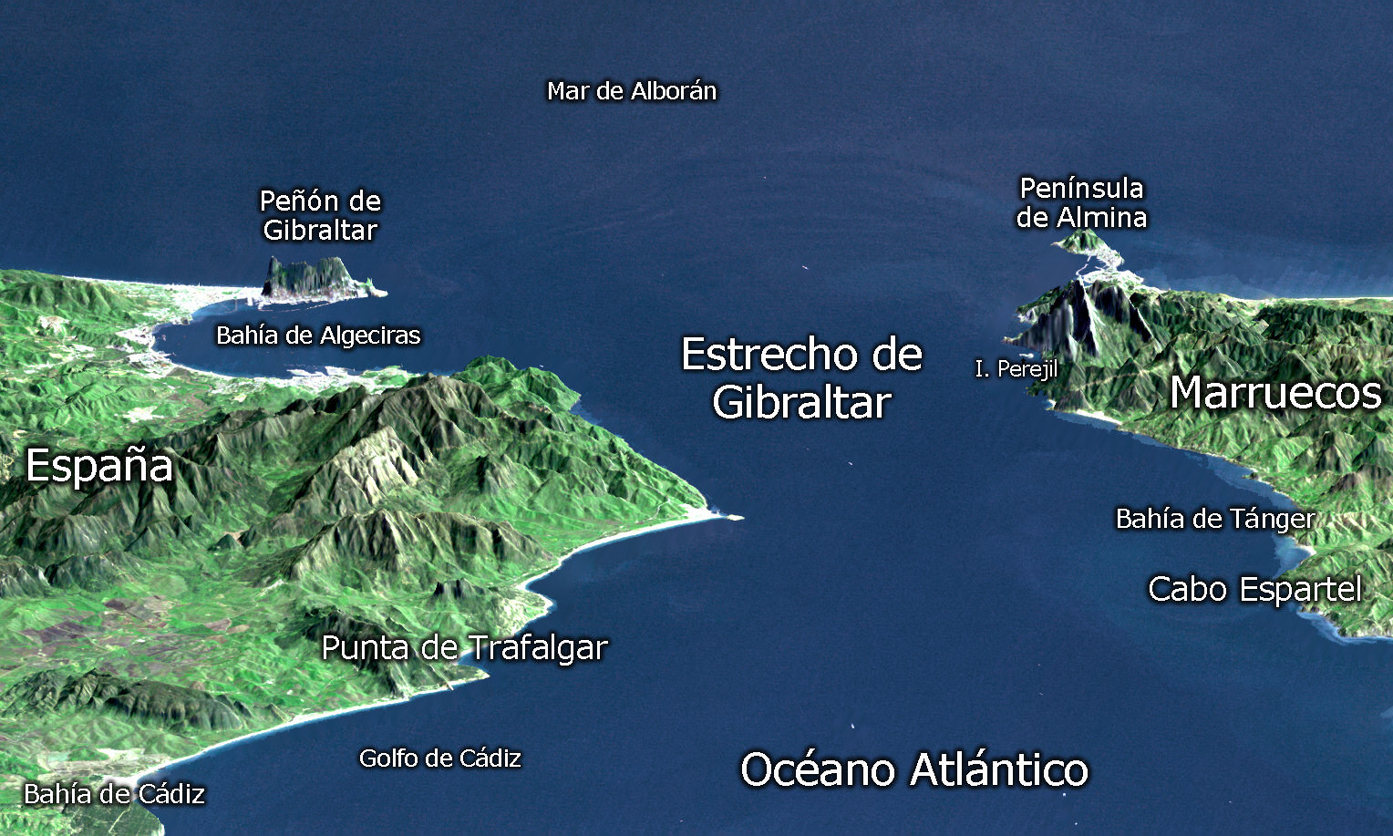
- Versión : Editada por SeRgio (Topografía).
View Size: 46 kilometers (28 miles) wide, 106 kilometers (66 miles) distance Location: 36 degrees North latitude, 5.5 degrees West longitude Orientation: Looking East, 15 degrees down from horizontal, 3X vertical exaggeration Image Data: Landsat bands 1, 2+4, 3 as blue, green, and red, respectively Original Data Resolution: 30 meters (99 feet) Date Acquired: February 2000 (SRTM), July 6, 1987 (Landsat)
| This file is in the public domain in the United States because it was solely created by NASA. NASA copyright policy states that "NASA material is not protected by copyright unless noted". (See Template:PD-USGov, NASA copyright policy page or JPL Image Use Policy.) | ||
 |
Warnings:
|
| Annotations | This image is annotated: View the annotations at Commons |
Eachdraidh an fhaidhle
Briog air ceann-là/àm gus am faidhle a shealltainn mar a nochd e aig an àm sin.
| Ceann-là/Àm | Dealbhag | Meud | Cleachdaiche | Beachd | |
|---|---|---|---|---|---|
| làithreach | 23:22, 27 dhen t-Samhain 2006 | | 1,528 × 917 (455 KB) | SeRgioo | * '''Desde :''' thumb|Original: http://earthobservatory.nasa.gov/Newsroom/NewImages/images.php3?img_id=16350 * '''Versión :''' Editada por SeRgio (Topografía). ---- View Size: 46 kilometers |
Cleachdadh an fhaidhle
Tha ceangal ris an fhaidhle seo san duilleag a leanas:
Cleachdadh fhaidhlichean uile-choitcheann
Tha na uicidhean eile a leanas a’ cleachdadh an fhaidhle seo
- Cleachdadh air ar.wikipedia.org
- Cleachdadh air bg.wikipedia.org
- Cleachdadh air bn.wikipedia.org
- Cleachdadh air ca.wikipedia.org
- Cleachdadh air de.wikipedia.org
- Cleachdadh air en.wikipedia.org
- Cleachdadh air es.wikipedia.org
- Cleachdadh air fr.wikipedia.org
- Cleachdadh air it.wikipedia.org
- Cleachdadh air ja.wikipedia.org
- Cleachdadh air la.wikipedia.org
- Cleachdadh air lv.wikipedia.org
- Cleachdadh air ml.wikipedia.org
- Cleachdadh air nn.wikipedia.org
- Cleachdadh air pt.wikipedia.org
- Cleachdadh air ru.wikipedia.org
- Cleachdadh air sr.wikipedia.org
- Cleachdadh air te.wikipedia.org
- Cleachdadh air zh.wikipedia.org