
Faidhle:Conon Bridge station - geograph.org.uk - 3324667.jpg
Meud an ro-sheallaidh seo: 800 × 556 piogsail. Dùmhlachdan-breacaidh eile: 320 × 223 piogsail | 640 × 445 piogsail | 1,024 × 712 piogsail | 1,280 × 890 piogsail | 2,560 × 1,780 piogsail | 3,200 × 2,225 piogsail.
Am faidhle tùsail (3,200 × 2,225 pixel, meud an fhaidhle: 1.57 MB, seòrsa MIME: image/jpeg)
Gearr-chunntas
| Tuairisgeul |
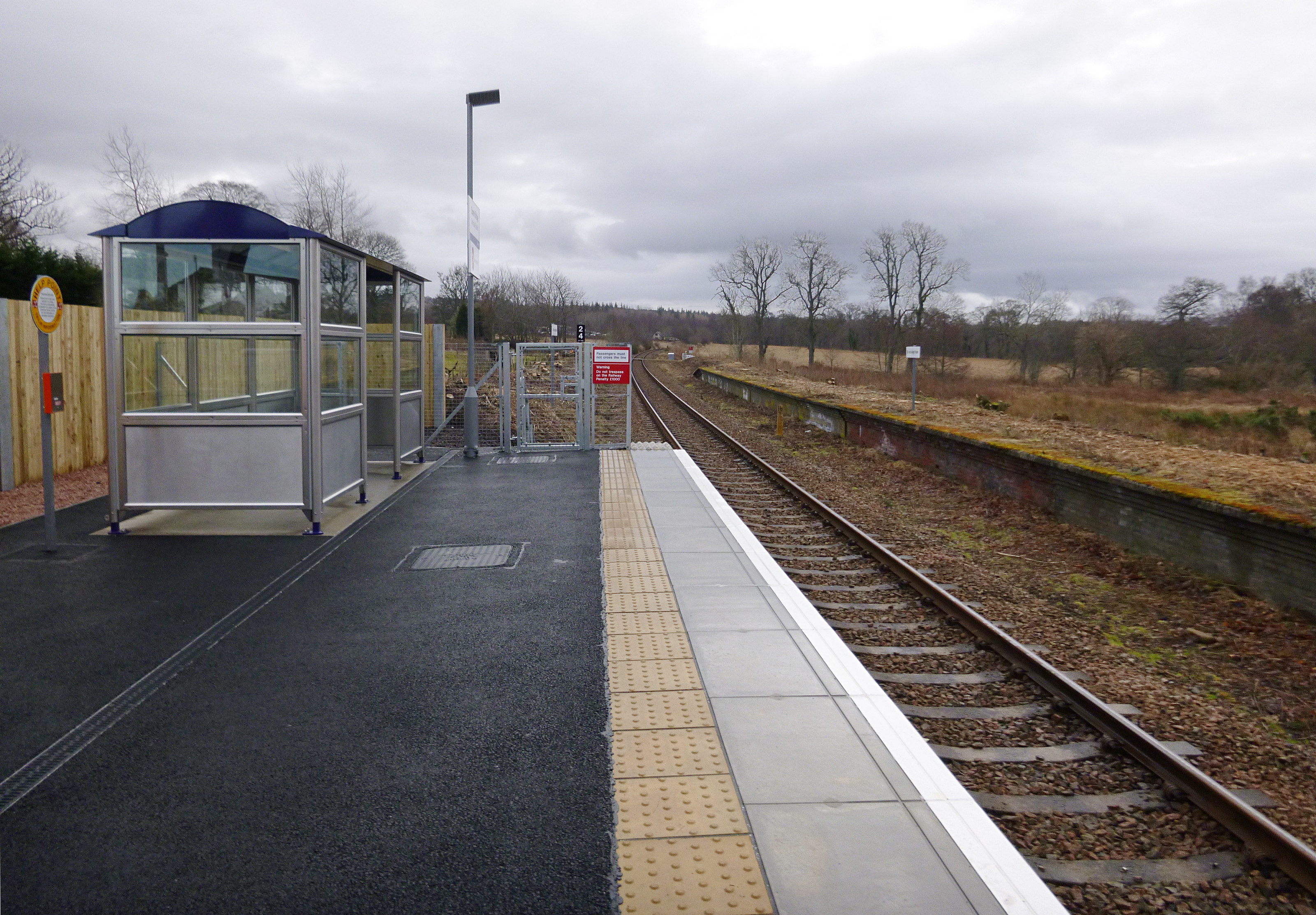
English: Conon Bridge station.
The original station on this site was named "Conon", and closed in 1960. A new station has been constructed, and opened today, 8 February 2013. It is a fairly basic station, similar to the nearby Beauly, which reopened 10 years ago. It has a single platform, a small shelter, a car park and bike parking. One of the original platforms is visible to the right, it now has signs saying "Do not alight here". Near to Conon Bridge, Highland, Great Britain. |
| Ceann-là | |
| Tùs | From geograph.org.uk; transferred by User:Vclaw using geograph_org2commons. |
| Ùghdar | Craig Wallace |
| Cead (Ag ath-chleachdadh an fhaidhle seo) |
Creative Commons Attribution Share-alike license 2.0 |
| Urram (required by the license) | Craig Wallace / Conon Bridge station / |
| Camera location | | View this and other nearby images on: OpenStreetMap |
|---|
| Object location | | View this and other nearby images on: OpenStreetMap |
|---|
_region:GB-GBN_heading:180.00&language=gd)
Ceadachadh

|
This image was taken from the Geograph project collection. See this photograph's page on the Geograph website for the photographer's contact details. The copyright on this image is owned by Craig Wallace and is licensed for reuse under the Creative Commons Attribution-ShareAlike 2.0 license.
|
This file is licensed under the Creative Commons Attribution-Share Alike 2.0 Generic license.
Urram: Craig Wallace
- Faodaidh tu:
- a cho-roinneadh – lethbhreac a dhèanamh dhen obair, a sgaoileadh is a tar-chur
- ath-mheasgachadh – an obair atharrachadh
- Fo bhuaidh nan cumhaichean a leanas:
- urram – Feumaidh tu iomradh a thoirt air an ùghdar no an neach aig a bheil cead air, dìreach mar a thoill iad (ach chan ann air dòigh a chuireas an sùilean dhaoine gu bheil iad ag aontachadh riut no ri d’ obair).
- co-roinneadh co-ionnann – Ma dh’atharraicheas tu no ma leasaicheas tu an obair seo, ’s urrainn an tionndadh ùr fon cheadachas seo no fo cheadachas coltach ris.
Eachdraidh an fhaidhle
Briog air ceann-là/àm gus am faidhle a shealltainn mar a nochd e aig an àm sin.
| Ceann-là/Àm | Dealbhag | Meud | Cleachdaiche | Beachd | |
|---|---|---|---|---|---|
| làithreach | 16:46, 9 dhen Ghearran 2013 | | 3,200 × 2,225 (1.57 MB) | File Upload Bot (Magnus Manske) |
Cleachdadh an fhaidhle
Tha ceangal ris an fhaidhle seo san duilleag a leanas:
Cleachdadh fhaidhlichean uile-choitcheann
Tha na uicidhean eile a leanas a’ cleachdadh an fhaidhle seo
- Cleachdadh air arz.wikipedia.org
- Cleachdadh air en.wikipedia.org
- Cleachdadh air www.wikidata.org