
Faidhle:Bartonsville Covered Bridge.jpg
Meud an ro-sheallaidh seo: 800 × 482 piogsail. Dùmhlachdan-breacaidh eile: 320 × 193 piogsail | 640 × 386 piogsail | 1,024 × 617 piogsail | 1,280 × 772 piogsail | 2,100 × 1,266 piogsail.
Am faidhle tùsail (2,100 × 1,266 pixel, meud an fhaidhle: 547 KB, seòrsa MIME: image/jpeg)
|
This is an image of a place or building that is listed on the National Register of Historic Places in the United States of America. Its reference number is 73000201. |
Gearr-chunntas
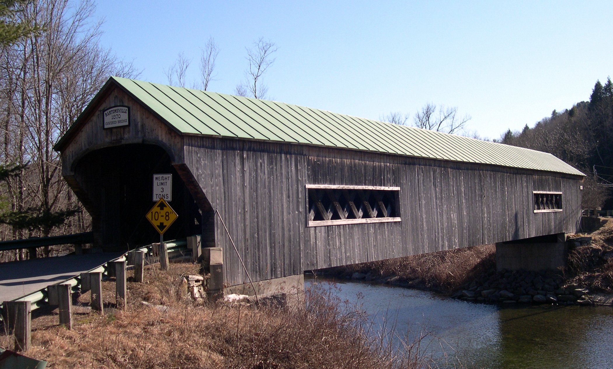
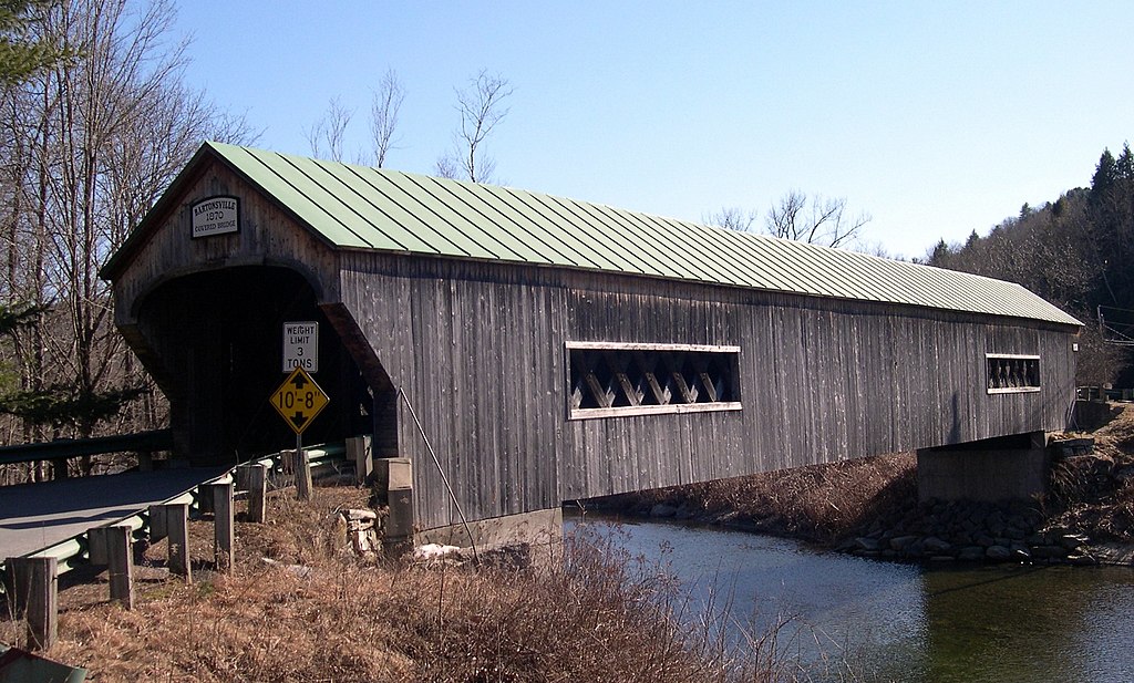
Bartonsville Covered Bridge, Bartonsville, Rockingham, Vermont
Ceadachadh
I, the copyright holder of this work, hereby publish it under the following licenses:

|
Permission is granted to copy, distribute and/or modify this document under the terms of the GNU Free Documentation License, Version 1.2 or any later version published by the Free Software Foundation; with no Invariant Sections, no Front-Cover Texts, and no Back-Cover Texts. A copy of the license is included in the section entitled GNU Free Documentation License. |
| Tha am faidhle seo fo cheadachas Creative Commons Attribution-Share Alike 3.0 Unported. | ||
| ||
| This licensing tag was added to this file as part of the GFDL licensing update. |
This file is licensed under the Creative Commons Attribution-Share Alike 2.5 Generic, 2.0 Generic and 1.0 Generic license.
- Faodaidh tu:
- a cho-roinneadh – lethbhreac a dhèanamh dhen obair, a sgaoileadh is a tar-chur
- ath-mheasgachadh – an obair atharrachadh
- Fo bhuaidh nan cumhaichean a leanas:
- urram – Feumaidh tu iomradh a thoirt air an ùghdar no an neach aig a bheil cead air, dìreach mar a thoill iad (ach chan ann air dòigh a chuireas an sùilean dhaoine gu bheil iad ag aontachadh riut no ri d’ obair).
- co-roinneadh co-ionnann – Ma dh’atharraicheas tu no ma leasaicheas tu an obair seo, ’s urrainn an tionndadh ùr fon cheadachas seo no fo cheadachas coltach ris.
’S urrainn dhut an ceadachas as fhearr leat a thaghadh.
| Object location | | View this and other nearby images on: OpenStreetMap |
|---|
Eachdraidh an fhaidhle
Briog air ceann-là/àm gus am faidhle a shealltainn mar a nochd e aig an àm sin.
| Ceann-là/Àm | Dealbhag | Meud | Cleachdaiche | Beachd | |
|---|---|---|---|---|---|
| làithreach | 01:19, 28 dhen Mhàrt 2006 | | 2,100 × 1,266 (547 KB) | Sfoskett~commonswiki | Bartonsville Covered Bridge, Bartonsville, Rockingham, Vermont Category:Vermont covered bridges |
Cleachdadh an fhaidhle
Tha ceangal ris an fhaidhle seo san duilleag a leanas:
Cleachdadh fhaidhlichean uile-choitcheann
Tha na uicidhean eile a leanas a’ cleachdadh an fhaidhle seo
- Cleachdadh air am.wikipedia.org
- Cleachdadh air ang.wikipedia.org
- Cleachdadh air an.wikipedia.org
- Cleachdadh air az.wikipedia.org
- Cleachdadh air bcl.wikipedia.org
- Cleachdadh air be-tarask.wikipedia.org
- Cleachdadh air be.wikipedia.org
- Cleachdadh air bg.wikipedia.org
- Cleachdadh air bi.wikipedia.org
- Cleachdadh air co.wikipedia.org
- Cleachdadh air cv.wikipedia.org
- Cleachdadh air cy.wikipedia.org
- Cleachdadh air da.wikipedia.org
- Cleachdadh air de.wikipedia.org
- Cleachdadh air diq.wikipedia.org
- Cleachdadh air el.wikipedia.org
- Cleachdadh air en.wikipedia.org
- Cleachdadh air et.wikipedia.org
- Cleachdadh air eu.wikipedia.org
- Cleachdadh air fo.wikipedia.org
- Cleachdadh air frp.wikipedia.org
- Cleachdadh air frr.wikipedia.org
- Cleachdadh air gl.wikipedia.org
- Cleachdadh air gn.wikipedia.org
- Cleachdadh air haw.wikipedia.org
- Cleachdadh air hif.wikipedia.org
- Cleachdadh air hi.wikipedia.org
- Cleachdadh air hr.wikipedia.org
- Cleachdadh air ik.wikipedia.org
- Cleachdadh air incubator.wikimedia.org
- Cleachdadh air io.wikipedia.org
- Cleachdadh air is.wikipedia.org
- Cleachdadh air jv.wikipedia.org
- Cleachdadh air kab.wikipedia.org
- Cleachdadh air ku.wikipedia.org
- Cleachdadh air kw.wikipedia.org
- Cleachdadh air la.wikipedia.org
- Cleachdadh air li.wikipedia.org
- Cleachdadh air mhr.wikipedia.org
- Cleachdadh air mk.wikipedia.org
- Cleachdadh air ml.wikipedia.org
- Cleachdadh air mrj.wikipedia.org
- Cleachdadh air ms.wikipedia.org
- Cleachdadh air nn.wikipedia.org
- Cleachdadh air no.wikipedia.org
Seall an corr dhen chleachdadh uile-choitcheann a nithear dhen fhaidhle seo.